
Other Historic Buildings & Sites (a selection)

Mull of Galloway Lighthouse
As part of the ‘Mull of Galloway Experience’, visit the historic lighthouse, first lit in 1830, on dramatic cliffs high above the Irish Sea at Scotland’s most southerly point. Climb the 115 steps to the top, view the exhibition of lighthouse history, and combine the occasion with walk options in experiencing the wildlife of the surrounding RSPB nature reserve. Lighthouse tours (certain days – check website link) and daily entry to exhibition, 30 March until 1 November. Gallie Craig coffee house open 5 days a week February-November. Free access to site 365 days a year.
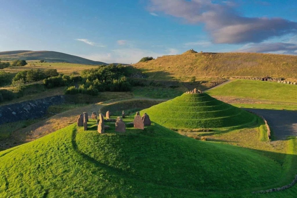
Crawick Multiverse (near Sanquhar)
Constructed on a site of important mining heritage, this extensive and quite astounding ‘land art installation’, spanning some 55 acres, caters to devotees of science, cosmology, art, history – or simply people wishing to explore its amazing landscape. Snack facilities, shop, toilets, and overnight campervan area on site. Open mid-March to early November (admission charge).

Port Logan Fishpond (near Stranraer)
Visit this Georgian fish larder on the beautiful Rhins of Galloway coast, dating from 1788 and constructed – by enlarging a natural hole in the rock – for Colonel Andrew McDowall of Logan. A themed museum and gift shop are contained in the quaint castle-style building alongside. Today the fishpond is home to a range of sea fish and marine life. Open throughout the year (reduced hours during winter). Small admission charge.
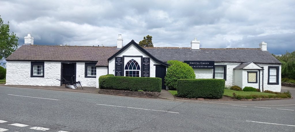
Gretna Green
Its position right on the national border with England saw this location acquire as international reputation for clandestine (by English law) ‘runaway’ marriages from the mid-eighteenth century onwards. Visit the famous Blacksmith’s Shop, scene of countless such civil ceremonies across the centuries, which continue to this day. Walk down from the Blacksmith’s vicinity and view the old Gretna kirk and graveyard, Bonnie Prince Charlie’s Cottage, and the sign-marked Border crossings between the two countries at the old bridges crossing the River Sark.
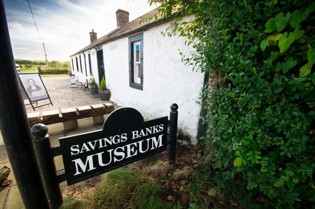
Ruthwell Savings Bank Museum & Ruthwell Cross
The museum is a small eighteenth-century building which marked the beginning of the world’s saving bank movement, as opened in 1810 by the Reverend Henry Duncan to assist poorer people securely ‘put something by.’ Now containing historical banking artefacts and an exhibition, tours are by arrangement (admission charge). While in the vicinity, explore the delightful historic parish church, which contains the eighth-century Anglo-Saxon ‘Ruthwell Cross’, and its fascinating old graveyard (admission free – approximately a one-mile walk from the bank museum).
Rosefield Mills (Dumfries) and riverside walk
Dumfries and Galloway is home to many magnificent examples of Industrial Heritage. Unfortunately, some of the structures face challenges of decay and dereliction. Here in Dumfries, overlooking the River Nith, and passed by a walkway, the enormous Victorian-era Rosefield Tweed Mills are currently the subject of a renovation project by the Dumfries Historic Buildings Trust. During the annual ‘Doors Open Day’ weekend, a section of the building can be visited. Either side of the mills, which have the appearance of some huge Venetian palace, year-round visiting options include Dumfries Museum, the Robert Burns Centre (housed in an 18th-century former water mill) and Troqueer church and graveyard.


Bladnoch Distillery (Wigtown)
Historic whisky distillery, Scotland’s southernmost, dating from 1817, on a tranquil spot beside the River Bladnoch downhill from Wigtown. Reopened in 2017, and continuing the tradition of producing pure Galloway whisky, the site boasts a visitor centre and café, with guided tour options (including sampling the produce!) available via booking.
Solway Military Trail
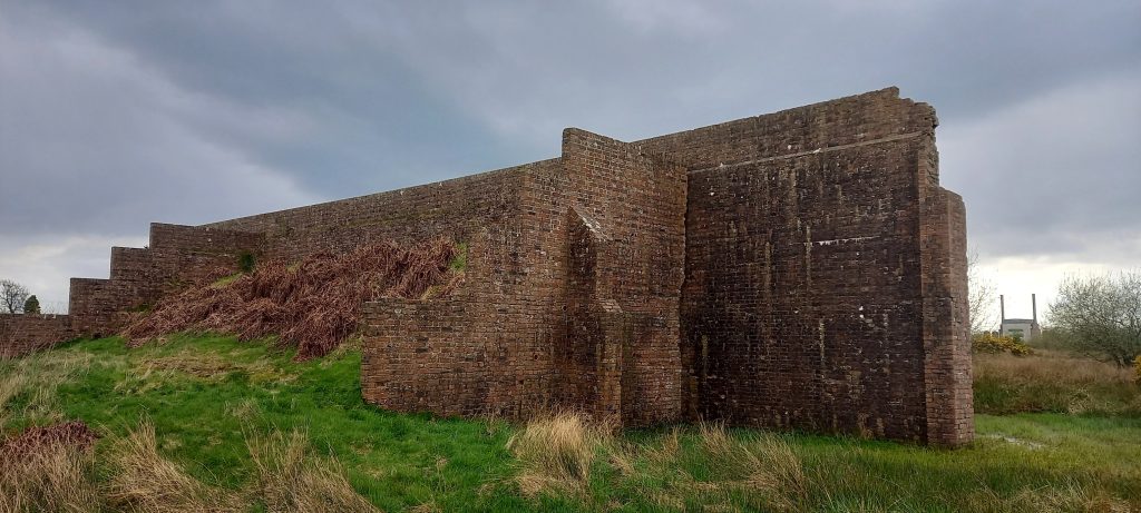
The Solway Military Trail comprises a series of trails relating principally (though not exclusively) to military sites in Dumfries and Galloway connected with the World Wars of the 20th century. While they have been designed to follow by car, yet on arriving at specific locations there is scope for exploration on foot. Features include two of the museums as listed at Dumfries (Aviation) and Eastriggs (Devil’s Porridge), shoreline walks passing remains of wartime structures, pillboxes, plus former munitions works with one exception (Powfoot) only viewable from their perimeters. An excellent website provides an abundance of information on the general and ‘sub’ trails. (image: RAF Annan target-practice block and tower of Chapelcross Nuclear Power Station in distance).
‘Lost Lines’: Railway Heritage
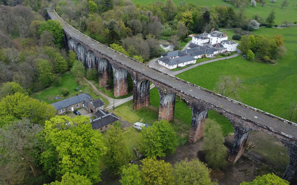
While Dumfries and Galloway is currently served by three ‘active’ railway lines, it was once criss-crossed by many more constructed during the Victorian ‘Golden Age of Steam’. And if the era of the 1960s ‘Beeching Cuts’ put paid to these, the lines (now minus their tracks) can be seen all over the region, if typically on farmland. Some sections of these have, however, been transformed into walking and cycling paths. A few cross former railway viaducts, with other examples of these often massive structures (such as that pictured at Goldielea, near Dumfries) viewable from other nearby paths or the roadside. The ‘Railscot’ site provides information (and images) on these ‘lost lines’ across the region, for example the lengthy ‘Port Road’ line from Castle Douglas to Portpatrick, with its route deviations owing to local topography, and also that linking Dumfries to Castle Douglas. Other lines linked Kirkcudbright with ‘CD’, Dumfries with Lockerbie via Lochmaben, and Beattock with Moffat. As well as viaducts and other features along the former lines, many station houses also survive, though have mostly been converted to private residences.