
Explore Dumfries (on foot)
Dumfries – ‘Queen of the South’
Founded as a royal burgh in the later-twelfth century, during the course of its long history Dumfries has been the scene of events of national importance. The slaying by Robert the Bruce of his Comyn rival for the Scottish throne at the town’s Greyfriars Monastery during 1306 relaunched the Scottish Wars of Independence – leading ultimately to Bruce’s famous victory over the English at Bannockburn in June 1314. Almost a half-millennium later, Dumfries became the home and final resting place of Robert Burns, Scotland’s internationally-renowned poet. In the intervening centuries it was much fought over in the process of Anglo-Scottish and also civil wars – plus developed as a port and into the nineteenth century as a point of departure for emigration overseas. Like many towns and cities, its historic core faces challenges of renewal and regeneration. Yet it has retained its original medieval layout, and many of its Georgian-era buildings and appeal. The biblical expression ‘Queen of the South’ as often applied to Dumfries originates with David Dunbar, a local poet, who stood for the 1857 General Election. It is also the official name of the town’s football club as established in 1919.
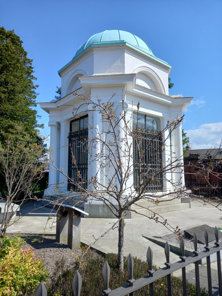
A good place to begin a walking tour of Dumfries, with free carparks available nearby, is the kirkyard (or graveyard) of St Michael’s Church beyond the southern end of the High Street. Here you will encounter Burns Mausoleum (pictured) which is opened most weekdays afternoons during the spring and summer and manned by a knowledgeable guide.
St Michael’s Kirk & Graveyard (and Robert Burns Mausoleum)
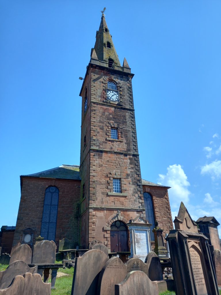
St Michael’s Church itself is a fine eighteenth-century structure built on the site of predecessor ‘kirks’, the first of which was likely erected over 1000 years ago. Within the surrounding graveyard you will find a wide array of funerary monuments – from slabstones and headstones to huge mural monuments and burial enclosures – marking the resting places and recording the history of both ‘ordinary’ and famous inhabitants of Dumfries and surrounding areas. Enjoy a pleasant, reflective, and informative stroll through this peaceful place in passing stones such as that raised to over 400 local cholera victims buried here following the epidemic of 1832. For keen history and genealogy enthusiasts, the town’s Ewart Library holds records of close on 1000 St Michael’s memorial inscriptions. Additionally a ‘Blue Plaque’ trail marks the graves of over 40 of Burns’ friends and contemporaries – with the centrepiece of the graveyard being undoubtedly the mausoleum of ‘The Bard’ himself.
Robert Burns House (and Museum)
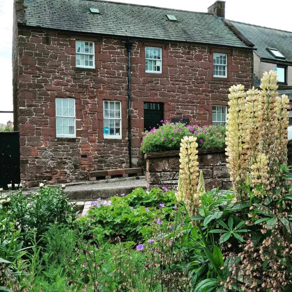
On leaving St Michael’s, head north in crossing the busy main road then walk up Burns Street where you will find Robert Burns House. Constructed in the red sandstone synonymous with Dumfriesshire, this was home to Robert Burns during the final years of the poet’s life until his death in 1796, aged thirty seven. It is now a place of pilgrimage for devotees of the Bard from around the world. Within, the museum shows us how he and his family lived. Open throughout the year (check seasonal opening hours via the link), admission free. Devotees of ‘Rabbie’ may also wish to follow the ‘In the Footsteps of Burns’ town centre trail as created by Dumfries and Galloway Council.
Georgian Townhouse: 24 Nith Place
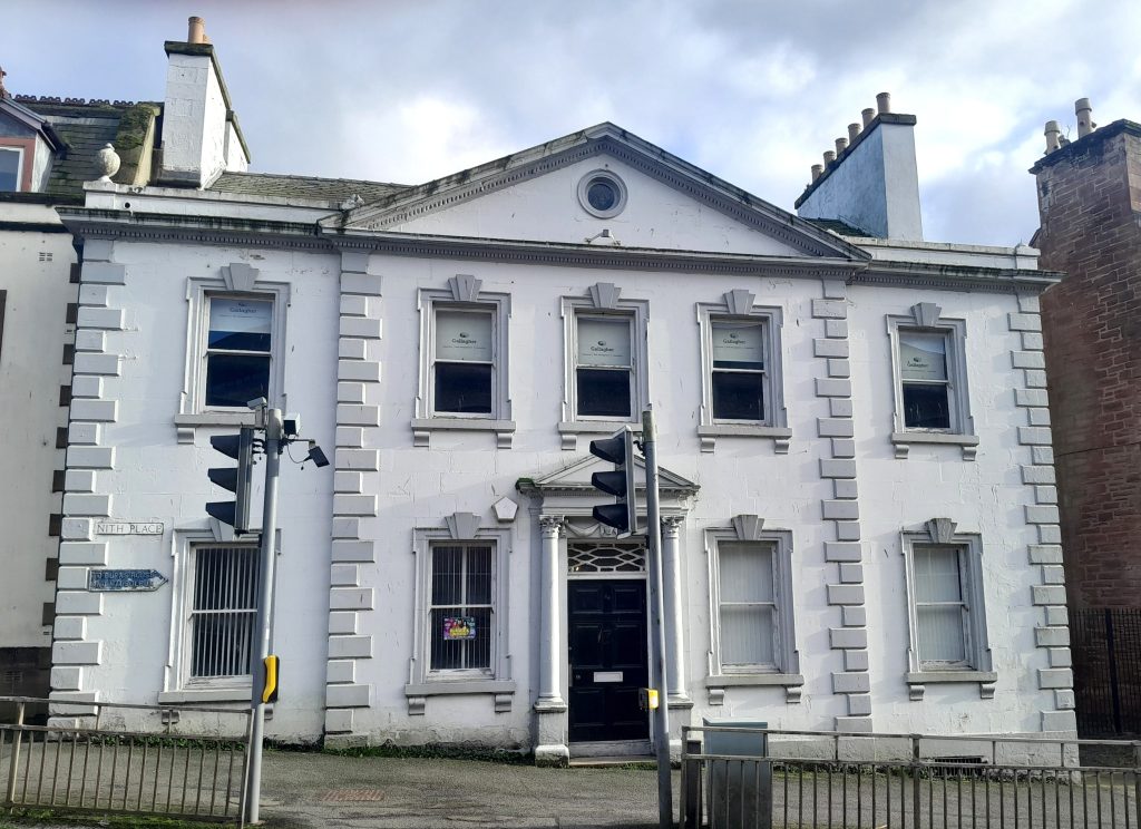
In continuing up Burns Street to another principal road, that of Shakespeare Street, turn left and continue down to the River Nith in passing by an example of the town’s Georgian built-heritage in the form of the elegant townhouse known as 24 Nith Place (facing the lower end of High Street).
Riverside and Rosefield Mills
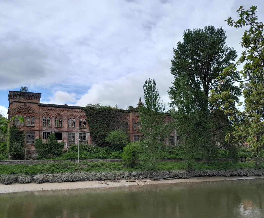
At the riverside, in diverting a short distance south along the walkway, over the river you will see the magnificent Victorian-era Rosefield Mills, resembling some Venetian palace and representing a legacy of the formerly important role played by Dumfries in the production of tweed. Currently derelict, it is the focus of a regeneration project on the part of the Dumfries Historic Buildings Trust. From this point, a further walk option (described below) follows the river south then diverts to the vicinity of the Crichton Estate – a former Victorian hospital comprising a collection of fine buildings including the cathedral-like Crichton Church.
Dumfries Museum & Camera Obscura
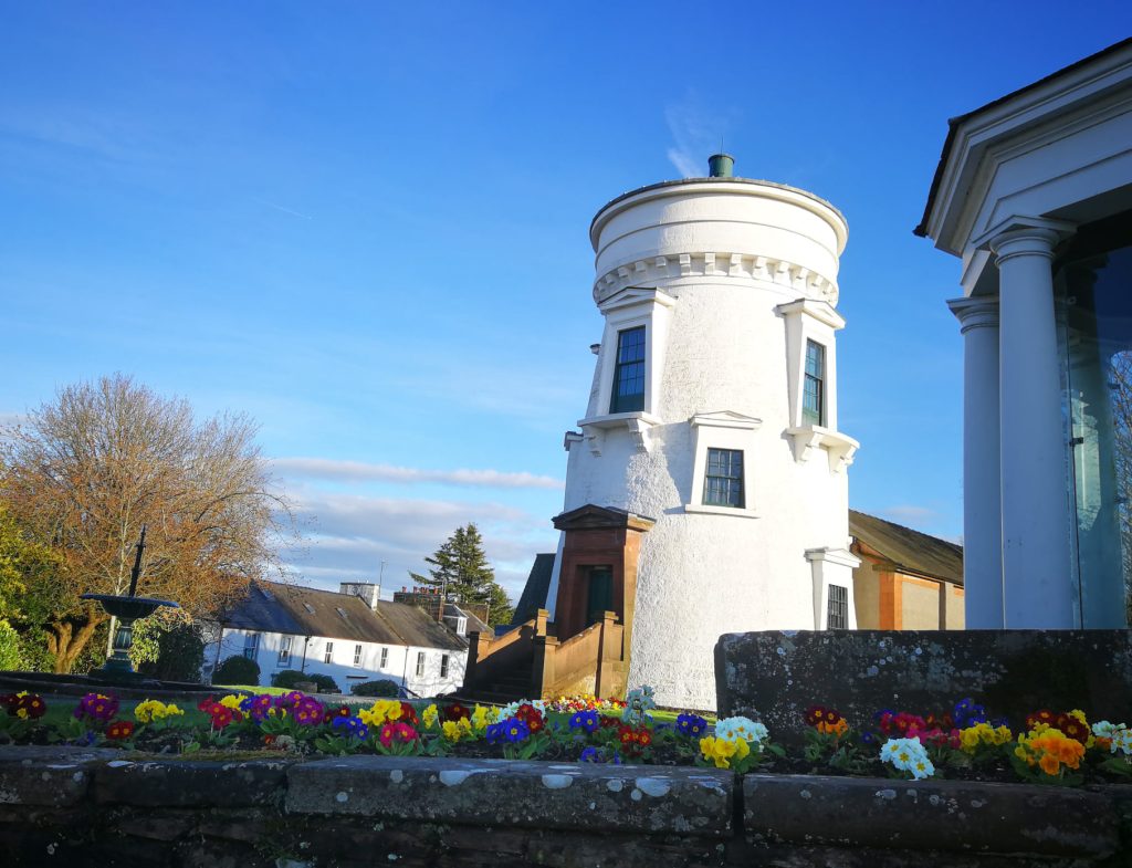
Retracing your steps to the point of the ornate Suspension Footbridge (completed 1875) cross the Nith and walk up the steep Suspension Brae, turning right onto Church Street and continuing until you see the impressive circular landmark tower indicating the vicinity of Dumfries Museum. A treasure trove of history relating to all things Dumfries and Galloway, the Museum tells the story of the land and people of the region. Look out for fossil footprints left by prehistoric animals, the wildlife of the Solway, tools and weapons of our earliest people, stone carvings by Scotland’s first Christians, and the everyday things of the Victorian farm, workshop, and home. Alongside the main museum is the Camera Obscura (pictured), an observatory dating from 1836 installed in an older windmill, and offering panoramic views of Dumfries and the surrounding countryside. Entry to the museum is free, with a small charge for the Camera Obscura (opened weather permitting).
Robert Burns Centre and the ‘Caul’
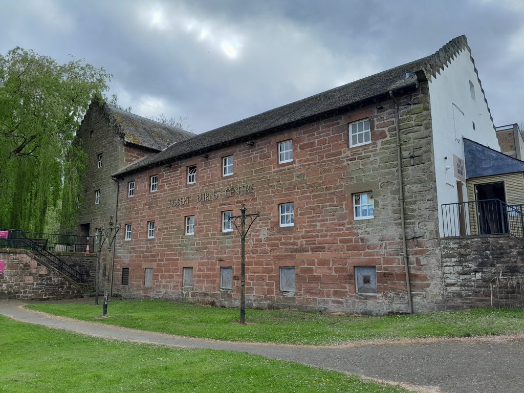
On leaving the Museum via the steps to the north, cross Church Street and walk down Millbrae Street (commencing with a pedestrian lane) to this western bank of the riverside, observing to your right the old mill which now serves as the Robert Burns Centre. From here there are good views up and down the river, including of four bridges and the ‘Caul’ – an eighteenth-century stone weir across the Nith which once served the mill with water to power its machinery. Today the building hosts an exhibition on Burns’ years in Dumfries, plus contains the small (69-seat) Robert Burns Centre Film Theatre (RBCFT). Open all year (see link for exact hours), café and ‘Bonnie Bistro’ restaurant, admission free.
Devorgilla Bridge and Old Bridge House Museum
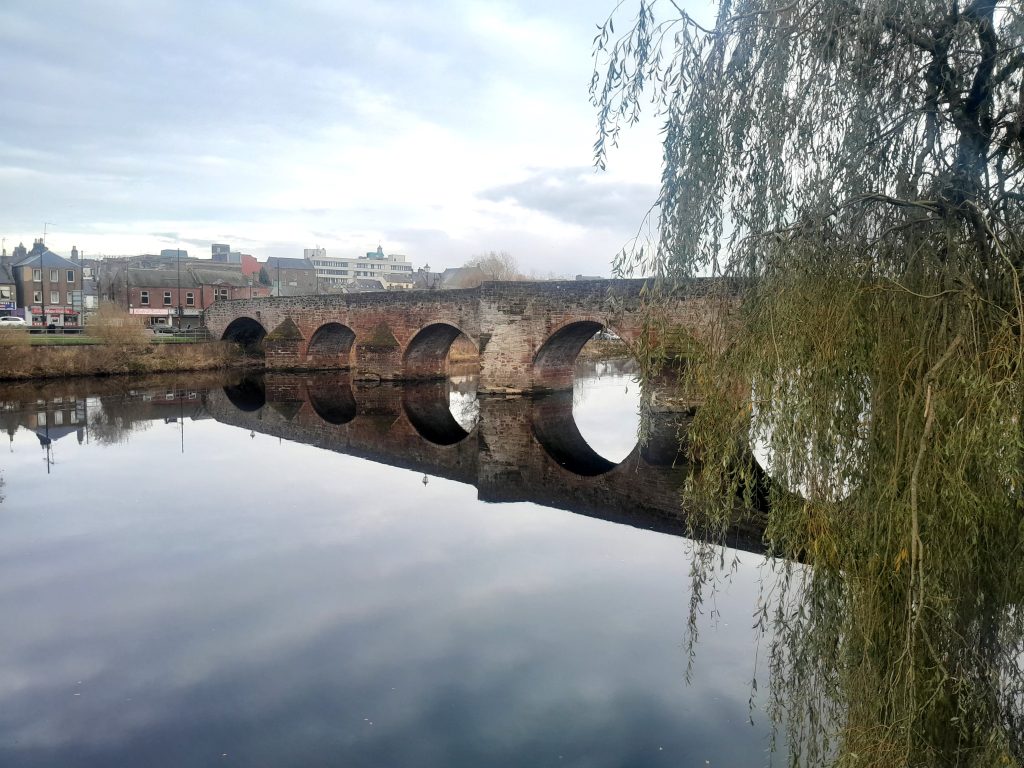
Progress north along the riverbank until you arrive at the iconic Devorgilla Bridge – first built c.1430 (on the site of an older bridge) if somewhat altered and repaired in following centuries. Before crossing, visit (admission free – check website link for opening hours) the Bridge House Museum, built in 1660 and attached to the bridge itself.
‘The Crossing’
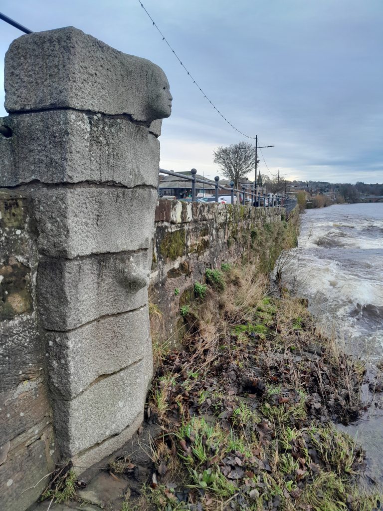
On crossing the bridge to the Whitesands, on this east side of the Caul you may notice the contemporary artwork ‘The Crossing’ – a representation of Lady Devorgilla emerging from stone in holding an ivory casket (in legend containing the embalmed heart of her husband, Lord John Balliol).
Burns Statue and vicinity
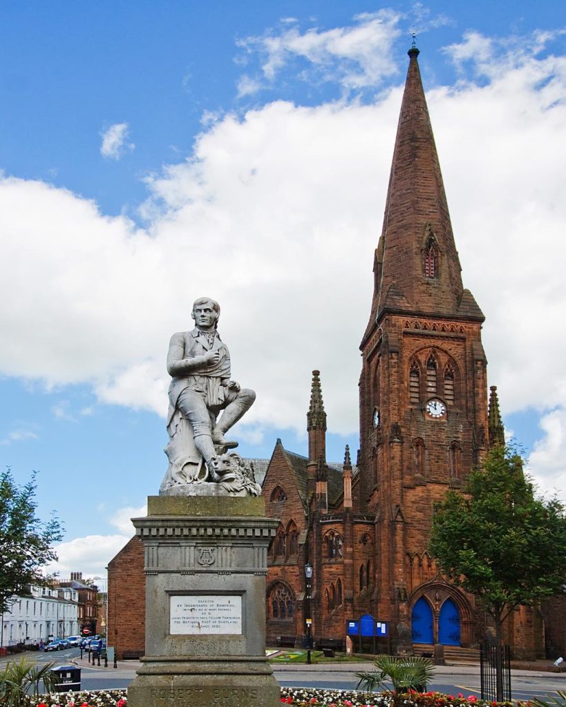
At the Crossing beside Devorgilla Bridge, traverse the road and head up the medieval artery of Friars Vennel (the Friars concerned having been Franciscans at the former monastery) to the High Street. Alternatively, walk a short distance north to inspect the ‘New’ Bridge (dated to the 1790s) then turn right along Buccleuch Street. Either way leads to the top of the High Street at Church Crescent, dominated by the statue of Robert Burns as unveiled in 1882, this standing against the backdrop of Greyfriars Church as built in the 1860s. In front of the church are information boards relating to the history of the building and also to the now-vanished monastery and ‘Maxwell’s Castle’. A few hundred yards north east up Academy Street stands the opulent structure of Dumfries Academy, again complimented with a set of heritage information boards, with the town’s famed Ewart Library located nearby on Catherine Street.
Moat Brae and the Georgian ‘New Town’
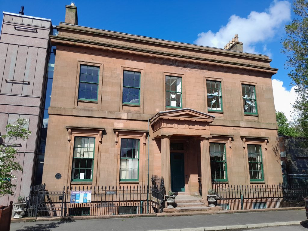
From the Burns Statue, walk north into the compact early-1800s ‘new town’ with its range of elegant townhouses and terraces, At the east end of this locale stands Moat Brae, the house which inspired JM Barrie (a graduate of Dumfries Academy) to write his classic work Peter Pan. Take a break at this point in dropping into ‘Pan’s Café’ next door.
High Street perambulation
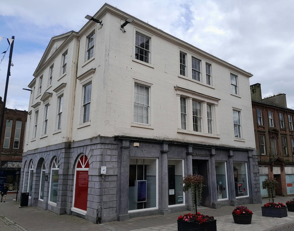
Returning to and walking south down the pedestrianised High Street, you will encounter stylish buildings dating mostly from the eighteenth and nineteenth centuries. Some admittedly face challenges of fabric maintenance, this due mainly to related issues of commercial relocation and non-occupancy. Others, however, have received a breath of new life thanks to regeneration projects. Alongside the large Queensberry Monument column is an example of such a structure in the fine Trades Hall of 1804 (pictured).
Midsteeple
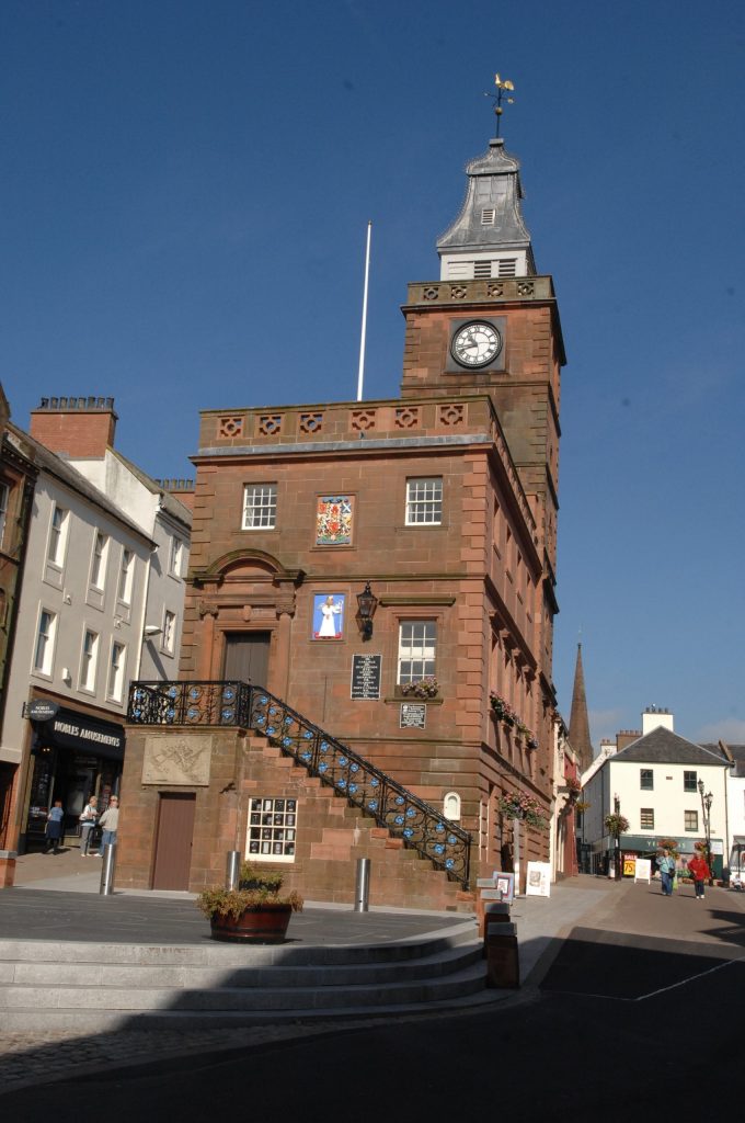
Approximately halfway along the High Street stands the attractive red sandstone Midsteeple, constructed in the early 1700s and serving the burgh as an early town hall and courthouse. In 1796 the body of Robert Burns lay here before his funeral on Monday 25 July. A huge funerary procession ran all the way to St Michael’s Church. The old burgh Mercat Cross formerly stood alongside, with the also now-vanished medieval Tolbooth just a short distance away. The immediate locale is home to the ‘Midsteeple Quarter’, a community-benefit society set up and run by the people of Dumfries. Diagonally down and across High Street from the Midsteeple, you will find a trio of quality cafés – notably that run by the Stove Network, a local Arts and Community organisation. (image credit: dng24).
The Fountain
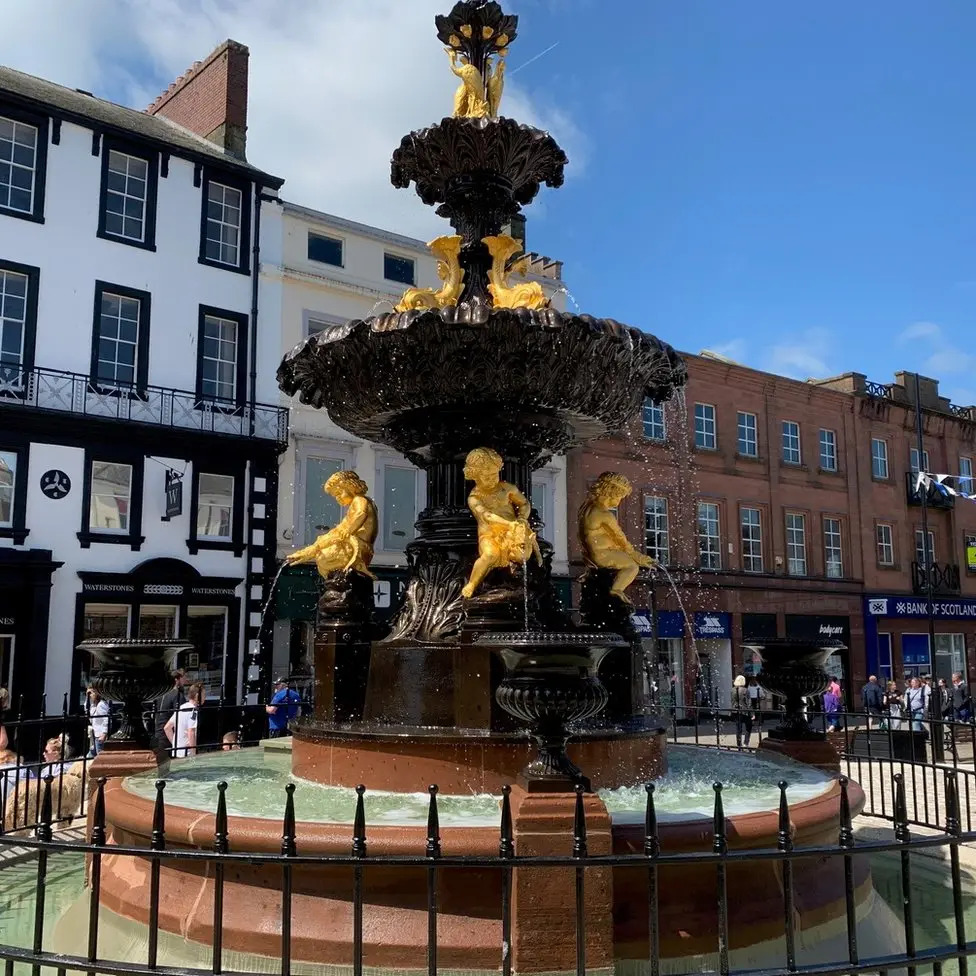
Further down, you will come across the magnificent and recently-restored fountain. Dated to 1882, it replaced a former fountain of 1851 erected to mark the piping of clean drinking water into Dumfries – a crucial development for the health of the inhabitants following devastating and deadly outbreaks of cholera in decades previous. (image credit: BBC).
Moorheads Poor House
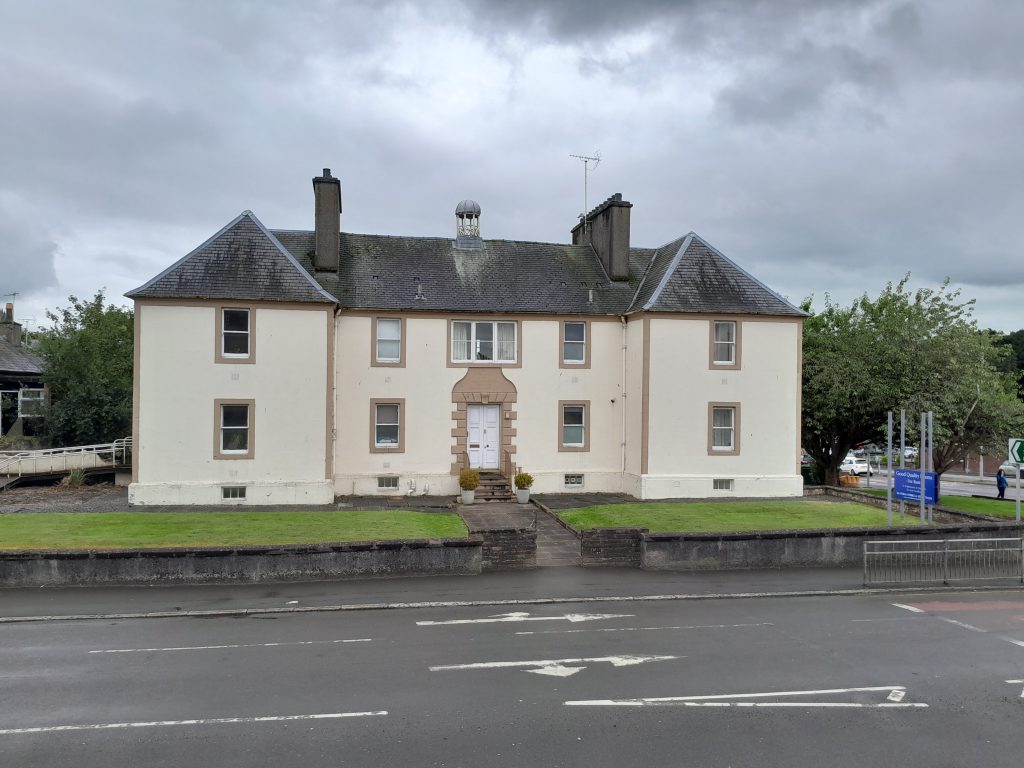
Returning to the beginning of our walking itinerary at St Michael’s Church, over the road you will see what opened in 1753 as ‘Moorheads’ Poor House (or ‘Paupers’ Hospital’). Progressing down from here to the riverside, you may wish to continue an exploration of the town to its leafy southern periphery – or keep that walk for another day!
Dock Park (Bandstand, Titanic Memorial)
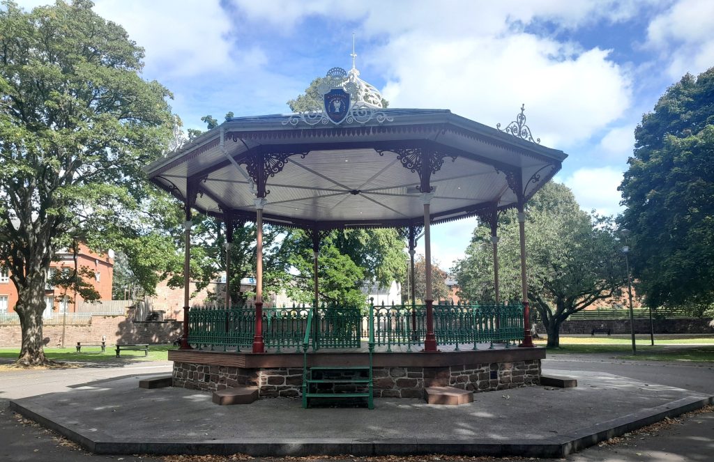
By continuing south you will enter Dock Park, passing ornate eighteenth-century cast-iron benches (bearing messages such as ‘For the Sick and Poor’), the beautiful bandstand (1898), and the Titanic Memorial. One of the two local men commemorated who lost their lives in the disaster was John Law Hume, a violinist with the fated ship’s orchestra. He had previously played in concerts given here on the bandstand. You may also notice a series of old mooring posts, these dating from the era when ships docked along this stretch of the Nith.
Lower Dock Park and Riverside
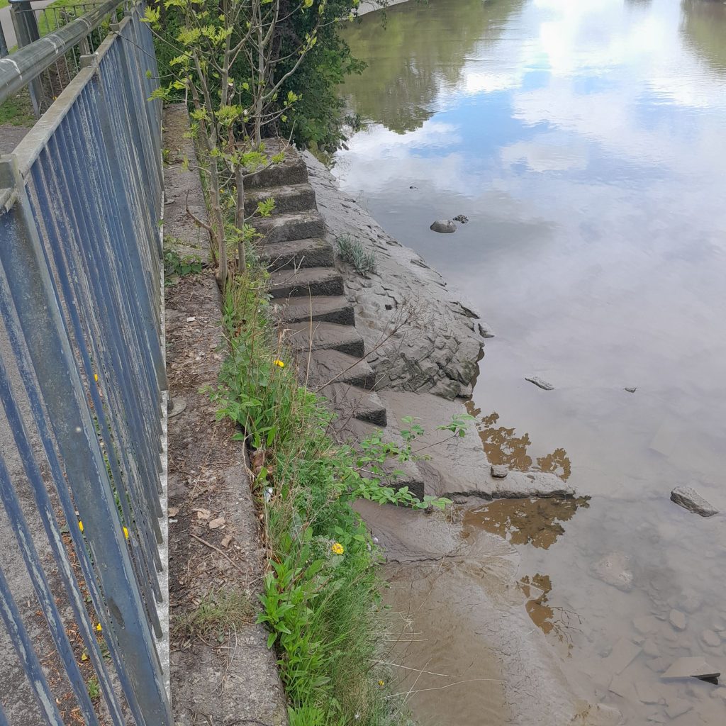
Continuing on, before entering Castledykes Park, look back up the river at the point of the recent (2006) Kirkpatrick Macmillan footbridge. Just beneath the bridge you might notice sets of steps which lead to old berthing places for boats. Another option here is to cross over to Troqueer.
Castledykes Park
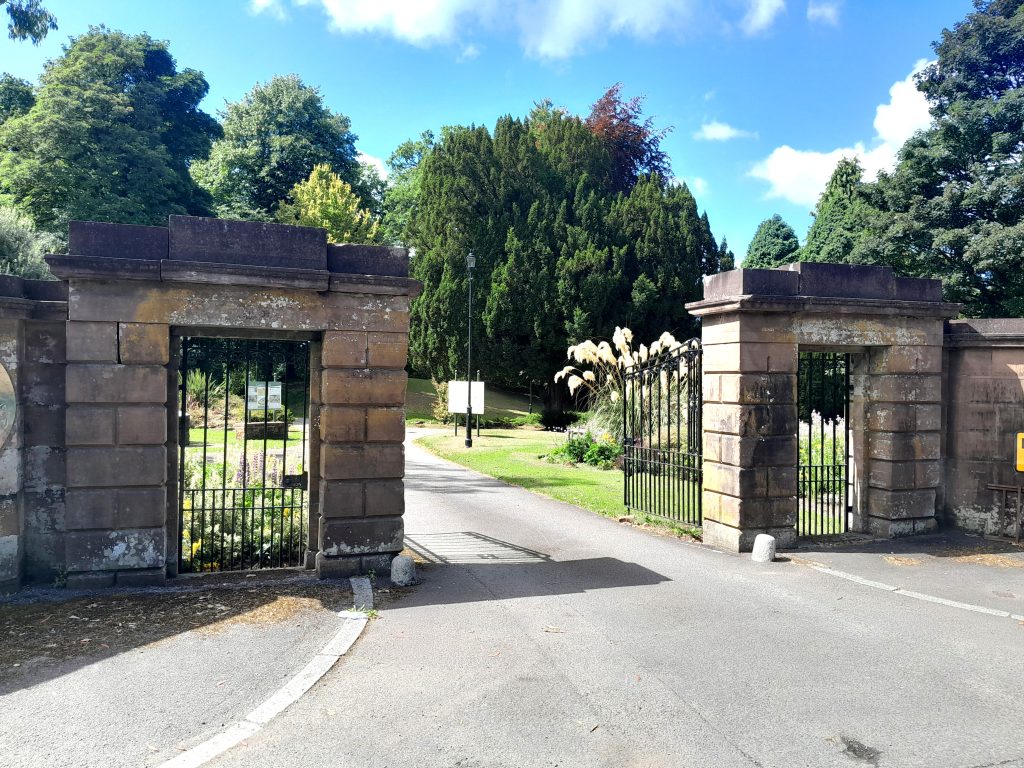
Castledykes Park derives its name from the large medieval castle which formerly stood within a vicinity which later became the landscaped gardens of a mansion house – like the castle itself long demolished. Several information boards within the grounds provide details on the history of the site. On passing through the park, you will arrive at the gates of the disappeared mansion on Glencaple Road. From this point, either return by the route previously taken (possibly via the footbridge over to Troqueer) or walk south and over Glencaple Road and enter the Crichton estate.
The Crichton Estate
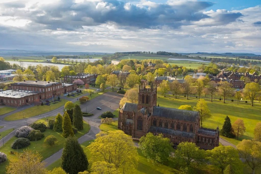
The 85-acre Crichton estate is a heritage site of national renown. It was formerly the location of a state-of-the-art psychiatric hospital first opened in 1839, representing a significant advance in the typically inhumane treatment of the mentally ill so common in ‘asylums’ elsewhere. The fine range of stylish buildings built over the course of a century mostly remain today, the majority now serving as business or educational premises – with a grouping of the latter forming the respected Crichton University Campus. The jewel in the crown of these impressive structures, and centrepiece of the estate, is the cathedral-like Crichton Memorial Church (still open for services) as completed in 1897. (image credit: The Crichton A place to breathe).
Troqueer
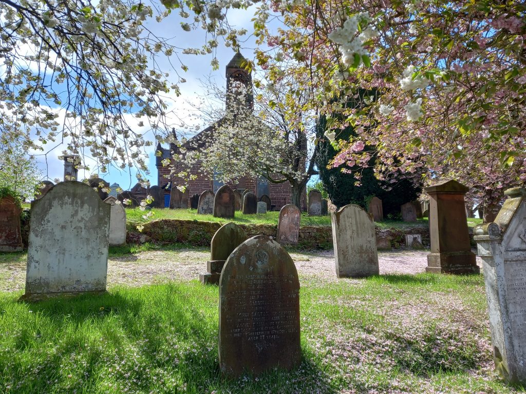
At the potential walk diversion across the Kirkpatrick Macmillan footbridge, a short trek will take you over to the historic parish church and graveyard of Troqueer – from where Dumfries Museum, and subsequently the main bridges back across the Nith to Dumfries town centre, are just another brief stroll away.
Lincluden Collegiate Church
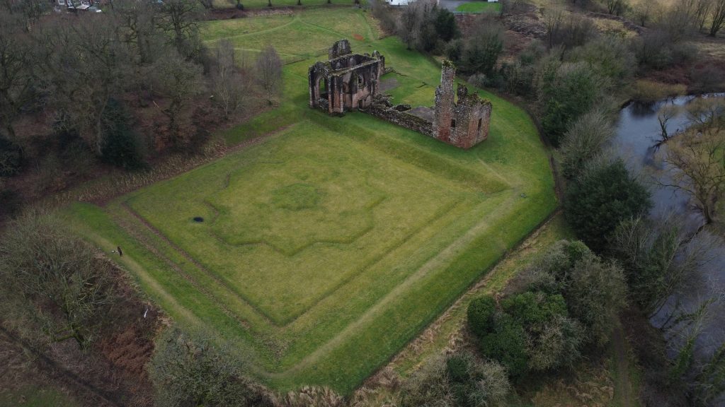
Near the west bank of the River Nith, situated alongside the tranquil Cluden Water, sit the medieval ruins of Lincluden Collegiate Church – which began life as a twelfth-century Benedictine nunnery. View the impressive remains of the church, including the fifteenth-century monumental tomb of Princess Margaret of Galloway, the ‘motte’ caste site, and the flanking Renaissance gardens. Located a few miles north of Dumfries centre, tucked in behind a housing estate, the ‘abbey’ is perhaps best reached by car, or bus from the Whitesands. Whichever mode of transport you take, just ask directions – ‘Doonhamers’ are friendly people!